 Landsat8影像下载
# 一、GEE下载Landsat8影像
GEE官网:
https://code.earthengine.google.com/ (opens new window)
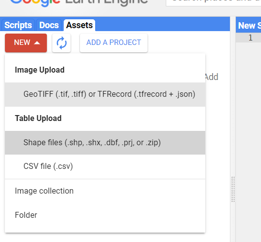
上传下载区域的矢量边界

GEE代码:
//首先,导入自己的研究区矢量数据
var ROI = ee.FeatureCollection("users/yunxingluoyun/Heze");
var ROI = ROI.geometry();

//然后,选择数据集和合成数据的时间范围
var dataset = ee.ImageCollection('LANDSAT/LC08/C02/T1')
    .filterDate('2021-11-01', '2021-12-01').filter(ee.Filter.lt("CLOUD_COVER",5));


//用clip()函数里面的行政边界切割
var ROI_collection = ee.Algorithms.Landsat.simpleComposite(dataset).clip(ROI)

print(ROI_collection)
Map.centerObject(ROI, 7);
//显示菏泽的shp边界
Map.addLayer(ROI,{color:'yellow',fillColor: "00000000", width: 1},'Heze Boundary');

//显示ROI影像并且以321合成,后面命名
Map.addLayer(ROI_collection,{bands:["B4","B3","B2"],gamma:1.3,max:108,min:15},'Heze Image');

//下载处理好的影像
Export.image.toDrive({
  image:ROI_collection,
  description: 'Landsat8_2021_11',
  fileNamePrefix:'Landsat8_heze',
  region:ROI,
  scale:30,
  crs: "EPSG:4326",
  maxPixels:1e13
})
1
2
3
4
5
6
7
8
9
10
11
12
13
14
15
16
17
18
19
20
21
22
23
24
25
26
27
28
29
30
31
2
3
4
5
6
7
8
9
10
11
12
13
14
15
16
17
18
19
20
21
22
23
24
25
26
27
28
29
30
31
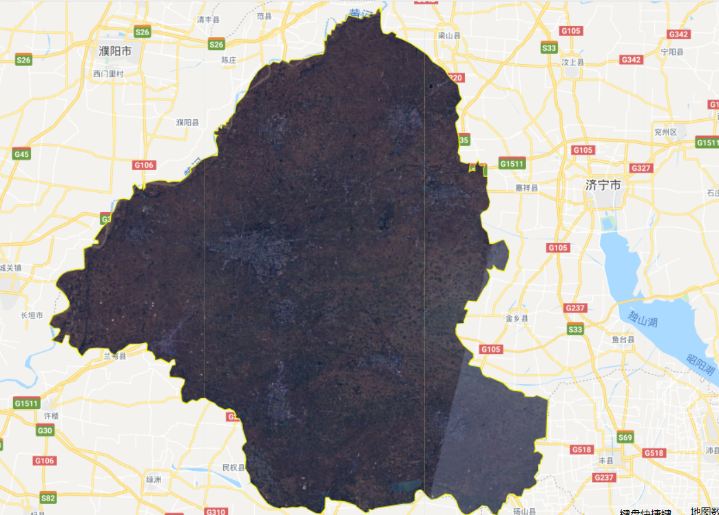
结果:

# 二、PIE下载Landsat8影像
PIE-Engine官网:
https://engine.piesat.cn/workbench/sign-in (opens new window)
例:下载济南地区Landsat8影像
PIE代码如下:
//确定区域
//首先,导入自己的研究区矢量数据
var roi = pie.FeatureCollection("NGCC/CHINA_CITY_BOUNDARY")
    .filter(pie.Filter.eq("name","济南市"))
    .first()
    .geometry();


//pie然后,选择数据集和合成数据的时间范围
//加载Landsat8 Collection2 SR数据集并日期、云量筛选
var img = pie.ImageCollection('LC08/02/SR')
            .filterBounds(roi)
            .filterDate("2021-1-1", "2021-12-5")
            .filter(pie.Filter.lt("cloud_cover", 2))
            .sort()
            .map(function(image){
                var qa = image.select('QA_PIXEL');
                var cloudMask = qa.bitwiseAnd(1<<3).eq(0);
                return image.updateMask(cloudMask);})
            .select(["B2", "B3", "B4"])
            .mosaic()
            .clip(roi);
print(img);

//按影像定位地图中心
Map.centerObject(roi, 7);
//显示HY的shp边界,后面‘’里面命名
Map.addLayer(roi,{color:'yellow', fillColor: "00000000", width: 1},'济南边界');
//加载显示影像
Map.addLayer(img, {min: 6000, max: 20000, bands: ["B4", "B3", "B2"]}, "img");

//导出影像到云盘
Export.imageToCloud({
  image:img,
  description: 'Landsat8',
  assetId:'Landsat8_Jinan1',
  region:roi,
  scale:30,
  crs: "EPSG:4326",
  maxPixels:1e13
})

/**
 * 导出影像,参数分别为:
 *  image:导出影像
 *  description:导出任务描述也就是任务名称
 *  assetId:导出的《资源》中数据集合路径
 *  region:导出范围
 *  scale:分辨率30米
 * */
/*
//导出到资源下
Export.image({
    image: img,
    description: "landsat8",
    assetId: "Landsat8_Jinan",
    region: roi,
    scale: 30
});
*/
1
2
3
4
5
6
7
8
9
10
11
12
13
14
15
16
17
18
19
20
21
22
23
24
25
26
27
28
29
30
31
32
33
34
35
36
37
38
39
40
41
42
43
44
45
46
47
48
49
50
51
52
53
54
55
56
57
58
59
60
2
3
4
5
6
7
8
9
10
11
12
13
14
15
16
17
18
19
20
21
22
23
24
25
26
27
28
29
30
31
32
33
34
35
36
37
38
39
40
41
42
43
44
45
46
47
48
49
50
51
52
53
54
55
56
57
58
59
60
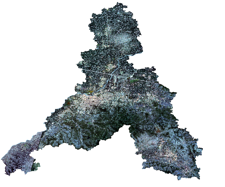
结果:


有问题,我来改改 (opens new window)
